© University of Liverpool 2019
FIELDWORKSAFETY


Kit - technical
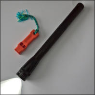
Whistle & torch
If you are working in remote areas or on the coast you should
carry a whistle and torch in order to give the International
Distress Signal should you become immobilised.
The International Distress Signal is:
•
6 blasts on a whistle (or 6 torch flashes)
•
Wait 1 minute and then repeat
Don’t forget to carry spare batteries and bulb to cover all
eventualities.

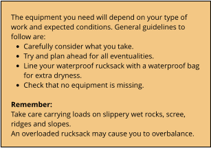
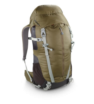
Rucksack
Ensure you use an appropriately sized rucksack. A small
rucksack or ‘day bag’ will suffice on day trips. A 35 litre capacity
rucksack is more than sufficient to carry the essential
equipment, spare clothing, food and water needed for a day
trip. For carrying heavier loads choose a rucksack with a hip
belt to spread the weight onto your hips. Carrying a rucksack
which is too heavy or badly packed will cause unnecessary
fatigue and potential back injury. Loads should be less than one
third of your body weight and rarely need to exceed 14kg. Pack
your rucksack with heavier items close to the back and less
dense items at the bottom of the bag.

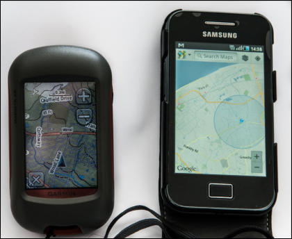
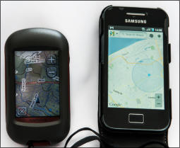
GPS
You can use specialist GPS equipment or use a GPS App on your
mobile phone to check where you are in the field. However, this
equipment can be unreliable if batteries fail or there is poor signal
reception and are no substitute for using a map and compass to work
out your exact position.
WARNING:
Under no circumstances should GPS be relied upon for determining
accurate height above sea level.
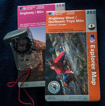
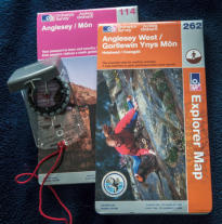
Map & compass
When working alone or in a small group you should carry a detailed
map of the area. This is good practice even when in a supervised
party just in case you become separated from the group. On guided
field courses use topographic maps (1:50 000 scale).
If working unsupervised use 1:10 000 or 1:25 000 scale maps. Record
the grid reference of each locality. In remote areas it is essential to
carry a compass for navigation and positioning.

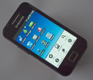
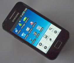
Mobile phone
This could be useful but remember reception can be poor in the
hills and on the coast below cliffs. As noted in the page 'Medical
emergencies it is worth registering your mobile phone with
emergency SMS.
WARNING:
Smart phones with apps should not be used as a substitute for
using map and compass equipment to position yourself.
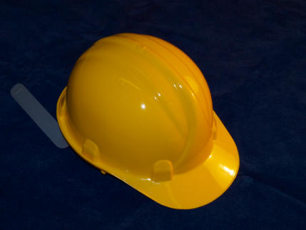
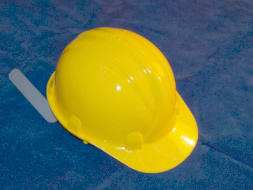
Safety helmet
A safety helmet is a hard hat that gives protection from falling
objects and during falls. It is one of the most essential items of
field equipment. The wearing of a hard hat is mandatory when
working in all quarries, under cliffs and rock faces, in areas of
nesting sea birds and in any place when there is danger from
above.
Safety helmets with a chinstrap are recommended when working
in the wind in exposed situations.
Kit - geological equipment
A geological hammer is used for taking samples and providing fresh rock
surfaces, but remember that much information is shown on weathered
surfaces. Only use hammers when absolutely necessary. Don’t take
samples indiscriminately and never use hammers other than geological
hammers. Hammering of brittle rocks can produce high velocity rock and
metal fragments so you will need protective gloves and goggles.
Cold chisels can be used for extracting specimens. Never use a second
hammer as a chisel - this is likely to produce high velocity metal fragments
which may cause serious injury to yourself and others.
Remember:
Hammers must never be used in a Site of Special Scientific Interest (SSSI).A compass-clinometer is essential for navigation and
positioning, particularly in remote areas or if you become
separated from your group.
This piece of equipment can also be used to measure:•
the altitude or thicknesss of inaccessible strata in
vertical cliff faces and
•
dip and strike of geological structures.
If you are planning to work in a remote area or outside the UK detailed maps may be unavailable.
Finding your position in such areas may be difficult. Before your visit information about geological
structure and lithological variation across the area in which you are planning to work may be
obtained from Google Earth.
A penknife is invaluable for a variety of uses including performing scratch tests to aid in
identification of minerals in the field.
Finally - don't forget that you will need a small rucksack to carry your geological equipment, spare
clothes and food and drink.
A good quality field notebook is essential for
recording field data. Notebooks should be sturdily
bound, have pages made of waterproof paper and
measure about 20x30cm in size. Larger notebooks
may not fit into your pocket; sketches will be harder
to record in smaller notebooks. When it is raining it
helps to use your notebook inside a clear plastic bag
that is large enough to cover your notebook and
hands.
Do not be tempted to buy cheap notebooks, they will
disintegrate within a few minutes of light rain.
You will need both hard and soft pencils for
recording data. These should be kept sharp. Don't
forget you will also need an eraser.
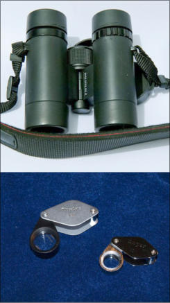
Binoculars can be very useful for
locating exposures and also for
checking the terrain in advance.
A hand lens is an essential piece of
equipment. Geologists cannot
adequately describe rocks without the
use of a hand lens. X5 to x10 is the
optimum magnification. (More
powerful lenses tend to obscure
textural relationships)
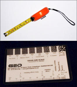
You may need to record
information regarding the
size of features. A grain
size card, combined with
the use of a hand lens will
make it easy to estimate the
grain size of sediments and
crystal size in igneous rocks.
It may also be used to
estimate roundness and
sphericity of sedimentary
grains. A metal tape rule is
useful for measuring bed
thicknesses.

Mobile phone
Rucksack
Map and compass
Safety helmet
GPS
Whistle & torch


© University of Liverpool 2019
FIELDWORKSAFETY


Kit - technical

Rucksack
Ensure you use an appropriately sized rucksack. A
small rucksack or ‘day bag’ will suffice on day trips. A
35 litre capacity rucksack is more than sufficient to
carry the essential equipment, spare clothing, food
and water needed for a day trip. For carrying heavier
loads choose a rucksack with a hip belt to spread the
weight onto your hips. Carrying a rucksack which is
too heavy or badly packed will cause unnecessary
fatigue and potential back injury. Loads should be
less than one third of your body weight and rarely
need to exceed 14kg. Pack your rucksack with heavier
items close to the back and less dense items at the
bottom of the bag.
Whistle & torch
If you are working in remote areas or on the
coast you should carry a whistle and torch
in order to give the International Distress
Signal should you become immobilised.
The International Distress Signal is:
•
6 blasts on a whistle (or 6 torch flashes)
•
Wait 1 minute and then repeat
Don’t forget to carry spare batteries and
bulb to cover all eventualities.

GPS
You can use specialist GPS equipment or
use a GPS App on your mobile phone to
check where you are in the field. However,
this equipment can be unreliable if
batteries fail or there is poor signal
reception and are no substitute for using a
map and compass to work out your exact
position.
WARNING:
Under no circumstances should GPS be
relied upon for determining accurate
height above sea level.
Map & compass
When working alone or in a small group you
should carry a detailed map of the area. This is
good practice even when in a supervised party
just in case you become separated from the
group. On guided field courses use topographic
maps (1:50 000 scale).
If working unsupervised use 1:10 000 or 1:25
000 scale maps. Record the grid reference of
each locality. In remote areas it is essential to
carry a compass for navigation and positioning.

Mobile phone
This could be useful but remember
reception can be poor in the hills and
on the coast below cliffs. As noted in
the page 'Medical emergencies it is
worth registering your mobile phone
with emergency SMS.
WARNING:
Smart phones with apps should not be
used as a substitute for using map and
compass equipment to position
yourself.
Safety helmet
A safety helmet is a hard hat that gives
protection from falling objects and
during falls. It is one of the most
essential items of field equipment. The
wearing of a hard hat is mandatory
when working in all quarries, under
cliffs and rock faces, in areas of nesting
sea birds and in any place when there is
danger from above.
Safety helmets with a chinstrap are
recommended when working in the
wind in exposed situations.
Kit - geological equipment


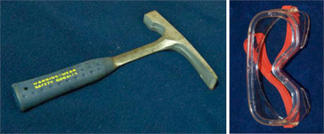
A geological hammer is used for taking samples and providing fresh rock surfaces, but
remember that much information is shown on weathered surfaces. Only use hammers when
absolutely necessary. Don’t take samples indiscriminately and never use hammers other than
geological hammers. Hammering of brittle rocks can produce high velocity rock and metal
fragments so you will need protective gloves and goggles.
Cold chisels can be used for extracting specimens. Never use a second hammer as a chisel - this
is likely to produce high velocity metal fragments which may cause serious injury to yourself and
others.
Remember:
Hammers must never be used in a Site of Special Scientific Interest (SSSI).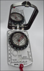
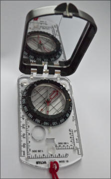
A compass-clinometer is essential for
navigation and positioning, particularly in
remote areas or if you become separated from
your group.
This piece of equipment can also be used to measure:•
the altitude or thicknesss of inaccessible
strata in vertical cliff faces and
•
dip and strike of geological structures.

If you are planning to work in a remote area or
outside the UK detailed maps may be unavailable.
Finding your position in such areas may be
difficult. Before your visit information about
geological structure and lithological variation
across the area in which you are planning to work
may be obtained from Google Earth.
A penknife is invaluable for a variety of uses
including performing scratch tests to aid in
identification of minerals in the field.
Finally - don't forget that you will need a small
rucksack to carry your geological equipment,
spare clothes and food and drink.
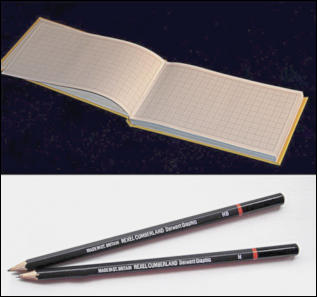
A good quality field notebook is essential for
recording field data. Notebooks should be
sturdily bound, have pages made of waterproof
paper and measure about 20x30cm in size.
Larger notebooks may not fit into your pocket;
sketches will be harder to record in smaller
notebooks. When it is raining it helps to use your
notebook inside a clear plastic bag that is large
enough to cover your notebook and hands.
Do not be tempted to buy cheap notebooks,
they will disintegrate within a few minutes of
light rain.
You will need both hard and soft pencils for
recording data. These should be kept sharp.
Don't forget you will also need an eraser.


Binoculars can be very useful for
locating exposures and also for
checking the terrain in advance.
A hand lens is an essential piece of
equipment. Geologists cannot
adequately describe rocks without the
use of a hand lens. X5 to x10 is the
optimum magnification. (More
powerful lenses tend to obscure
textural relationships)

You may need to record information regarding the
size of features. A grain size card, combined with the
use of a hand lens will make it easy to estimate the
grain size of sediments and crystal size in igneous
rocks. It may also be used to estimate roundness and
sphericity of sedimentary grains. A metal tape rule is
useful for measuring bed thicknesses.